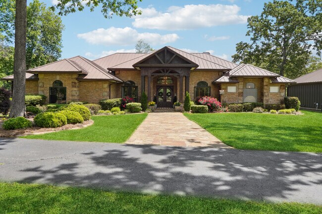
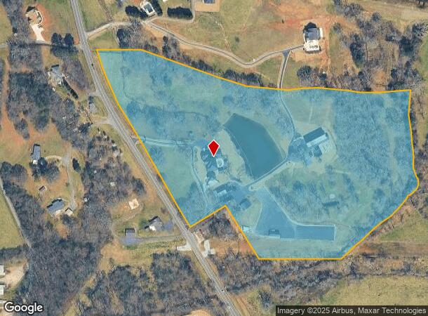
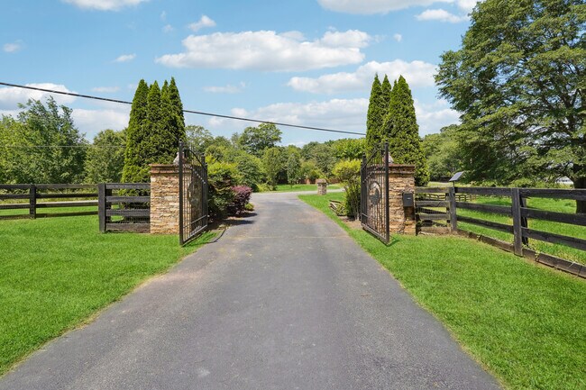
Property Record
5150 Dahlonega Hwy, Cumming, GA 30028

NEARBY LISTINGS FOR SALE OR LEASE
-
-
-
No Photo
-
-
-
-
-
View all Cumming listings for sale on LoopNet.com
Property Detail
5150 Dahlonega Hwy
Atlanta-Sandy Springs-Roswell, GA
Silver City
187-021
3-1 253-254
Agriculturalland
Forsyth
AE
Georgia
13117C0065G
253
2024
N Fulton/Forsyth County
2025
Atlanta
130203
DEMOGRAPHICS near 5150 Dahlonega Hwy
1 Mile
3 Mile
5 Mile
2024 Total Population
2,871
23,723
53,011
2029 Population
3,332
27,932
63,444
Pop Growth 2024-2029
+ 16.06%
+ 17.74%
+ 19.68%
Average Age
36
38
38
2024 Total Households
886
7,816
17,721
HH Growth 2024-2029
+ 16.25%
+ 17.87%
+ 19.93%
Median Household Inc
$110,905
$108,594
$103,799
Avg Household Size
3.20
3.00
2.90
2024 Avg HH Vehicles
2.00
2.00
2.00
Median Home Value
$366,176
$372,831
$364,234
Median Year Built
2007
2006
2004
Nearby Places
Map Layers
Map Styles
 Street
 Aerial
- Restaurants
- Banks
- Shops
- Fitness
- Groceries
SALE & LEASE HISTORY
LISTING DATE
SALE/LEASE

May 20, 2024
For Sale
Nearby Properties
Address
Land Use
TOTAL SIZE
Lot Size
Zoning
Address
Land Use
TOTAL SIZE
Lot Size
Zoning
57,180 SF
61.71 AC
RES6
Address
Land Use
TOTAL SIZE
Lot Size
Zoning
28.74 AC
MP
Address
Land Use
TOTAL SIZE
Lot Size
Zoning
413,484 SF
127.99 AC
A1
Address
Land Use
TOTAL SIZE
Lot Size
Zoning
16,221 SF
16.44 AC
CBD
Address
Land Use
TOTAL SIZE
Lot Size
Zoning
19.21 AC
M1
Address
Land Use
TOTAL SIZE
Lot Size
Zoning
59,534 SF
16.93 AC
CBD
Address
Land Use
TOTAL SIZE
Lot Size
Zoning
192,550 SF
21.11 AC
CBD
Address
Land Use
TOTAL SIZE
Lot Size
Zoning
130,686 SF
41.98 AC
R2R
Address
Land Use
TOTAL SIZE
Lot Size
Zoning
80,497 SF
9.22 AC
CBD
Address
Land Use
TOTAL SIZE
Lot Size
Zoning
12,217 SF
3.85 AC
CBD
Address
Land Use
TOTAL SIZE
Lot Size
Zoning
3.90 AC
M1
Address
Land Use
TOTAL SIZE
Lot Size
Zoning
54,090 SF
8.70 AC
CBD
Address
Land Use
TOTAL SIZE
Lot Size
Zoning
2,955 SF
5.88 AC
NS
Address
Land Use
TOTAL SIZE
Lot Size
Zoning
40,092 SF
3.35 AC
M1
Address
Land Use
TOTAL SIZE
Lot Size
Zoning
651 SF
41.02 AC
A1
Address
Land Use
TOTAL SIZE
Lot Size
Zoning
47,205 SF
40.23 AC
A1
Address
Land Use
TOTAL SIZE
Lot Size
Zoning
31,423 SF
4.30 AC
CBD
Address
Land Use
TOTAL SIZE
Lot Size
Zoning
34,658 SF
3.63 AC
M1
Address
Land Use
TOTAL SIZE
Lot Size
Zoning
1,152 SF
30.02 AC
OR
Address
Land Use
TOTAL SIZE
Lot Size
Zoning
6.93 AC
M1
Address
Land Use
TOTAL SIZE
Lot Size
Zoning
16,300 SF
3.85 AC
PUD
Address
Land Use
TOTAL SIZE
Lot Size
Zoning
11,412 SF
7.69 AC
CBD
Address
Land Use
TOTAL SIZE
Lot Size
Zoning
18,900 SF
2.67 AC
CBD
Address
Land Use
TOTAL SIZE
Lot Size
Zoning
18,900 SF
2.23 AC
CBD
Address
Land Use
TOTAL SIZE
Lot Size
Zoning
27.80 AC
M1
Address
Land Use
TOTAL SIZE
Lot Size
Zoning
34,751 SF
15.80 AC
CBD
Address
Land Use
TOTAL SIZE
Lot Size
Zoning
17,920 SF
1.55 AC
CBD
Address
Land Use
TOTAL SIZE
Lot Size
Zoning
16,186 SF
32.27 AC
MP
Address
Land Use
TOTAL SIZE
Lot Size
Zoning
1,970 SF
61.47 AC
RPC
Address
Land Use
TOTAL SIZE
Lot Size
Zoning
1,152 SF
MCD
The World's #1 Commercial Real Estate Marketplace
Connect with us
© 2025 CoStar Group
The information above has been obtained from sources believed reliable. While we do not doubt its accuracy we have not verified it and make no guarantee, warranty or representation about it. It is your responsibility to independently confirm its accuracy and completeness. Any projections, opinions, assumptions, or estimates used are for example only and do not represent the current or future performance of the property. The value of this transaction to you depends on tax and other factors which should be evaluated by your tax, financial, and legal advisors. You and your advisors should conduct a careful, independent investigation of the property to determine to your satisfaction the suitability of the property for your needs.